If you call Canada’s Iceberg Highway home, you’ll never run out of icebergs to admire. In spring, when the surrounding sea ice melts, these icy behemoths become even more striking, revealing their rugged textures and shimmering blue hues.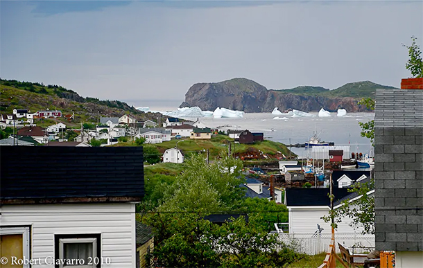 Waking up on icebergs. Image credit: Robert Ciavarro
Most of these icebergs originate in Greenland, where vast chunks of glaciers calve off during the warmer months. Carried by powerful ocean currents, they journey southward through Baffin Bay and into the Labrador Sea, slowly making their way towards Newfoundland before eventually melting. A smaller number of icebergs originate from the Canadian Arctic, following a similar path through Davis Strait and into the Atlantic waters surrounding Newfoundland’s eastern and western coasts.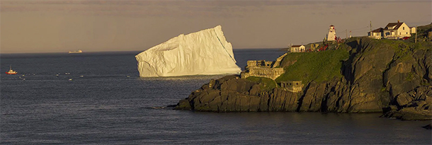 Enormous iceberg near Fort Amherst in St. John’s, Newfoundland and Labrador, Canada. Photo: Zach Bonnell
These icebergs are remnants of glaciers that formed over 10,000 years ago, with an estimated 400 to 800 making their way through Iceberg Highway each year. Their movement depends on several factors, including size, shape, ocean currents, wind, and wave action. On average, they drift at a speed of approximately 0.4 miles per hour.
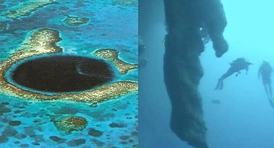
While these icebergs may appear massive, what you see is just the “tip of the iceberg.” Only about 10 percent of an iceberg is visible above the waterline—the rest remains hidden beneath the ocean surface.According to Atlas Obscura, there are six distinct types of icebergs, all of which can be found in Iceberg Highway. Tabular icebergs are large, flat slabs with a greater width than height. Blocky icebergs have sharp, defined edges and resemble truncated pyramids. Wedge icebergs feature one steep side and one sloping side. Dome icebergs have rounded tops, while pinnacle icebergs have one or more towering spires. Lastly, dry dock icebergs are U-shaped, with an open space in the middle.
Navigating around icebergs can be risky due to their unpredictable nature. For safety, it is advised to maintain a minimum safe distance (D) of either the iceberg’s total length (L) or twice its height (H), whichever is greater. Within this perimeter, there is a heightened risk of falling ice, large waves, and submerged hazards.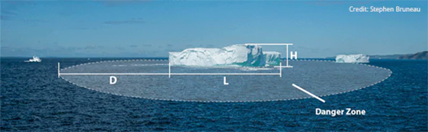
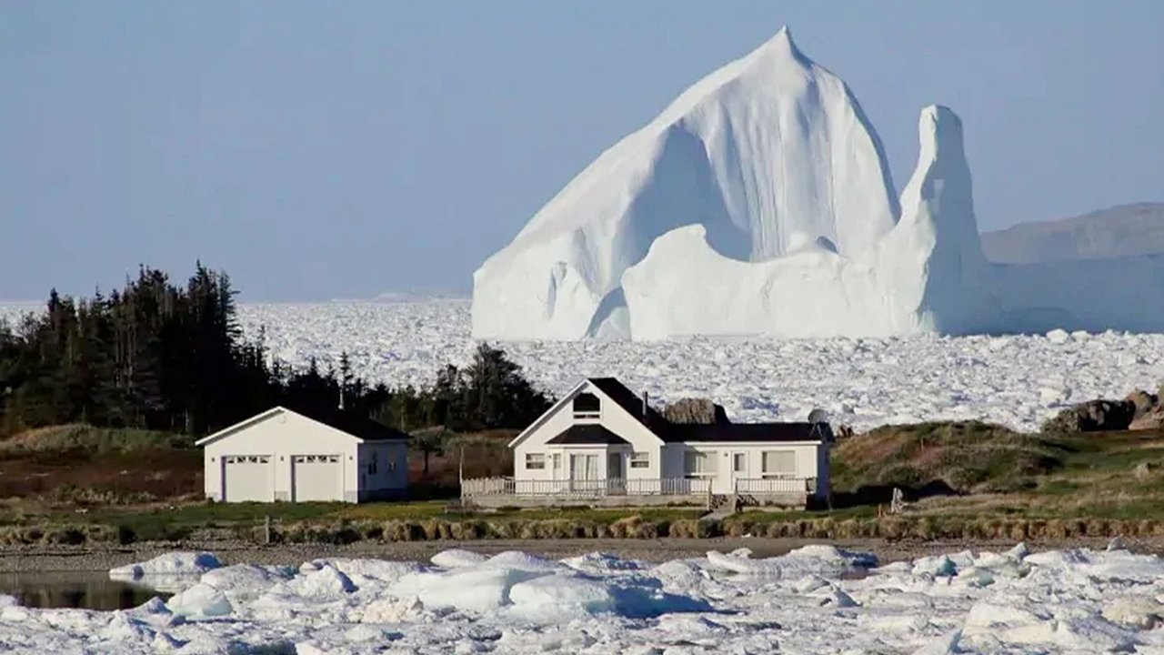
As icebergs drift southward into progressively warmer waters, they melt at an increasing rate, becoming even more unstable. This unpredictability is what led to the infamous Titanic disaster off the coast of Newfoundland in 1912. While modern satellite technology allows us to track medium and large icebergs, smaller ones often go undetected, posing a significant threat to smaller vessels. One of the most famous icebergs in recent memory made global headlines in 2017 when it appeared beside a small Newfoundland town, completely overshadowing it with its towering presence.
Waking up on icebergs. Image credit: Robert CiavarroMost of these icebergs originate in Greenland, where vast chunks of glaciers calve off during the warmer months. Carried by powerful ocean currents, they journey southward through Baffin Bay and into the Labrador Sea, slowly making their way towards Newfoundland before eventually melting. A smaller number of icebergs originate from the Canadian Arctic, following a similar path through Davis Strait and into the Atlantic waters surrounding Newfoundland’s eastern and western coasts.
Enormous iceberg near Fort Amherst in St. John’s, Newfoundland and Labrador, Canada. Photo: Zach BonnellThese icebergs are remnants of glaciers that formed over 10,000 years ago, with an estimated 400 to 800 making their way through Iceberg Highway each year. Their movement depends on several factors, including size, shape, ocean currents, wind, and wave action. On average, they drift at a speed of approximately 0.4 miles per hour.
While these icebergs may appear massive, what you see is just the “tip of the iceberg.” Only about 10 percent of an iceberg is visible above the waterline—the rest remains hidden beneath the ocean surface.According to Atlas Obscura, there are six distinct types of icebergs, all of which can be found in Iceberg Highway. Tabular icebergs are large, flat slabs with a greater width than height. Blocky icebergs have sharp, defined edges and resemble truncated pyramids. Wedge icebergs feature one steep side and one sloping side. Dome icebergs have rounded tops, while pinnacle icebergs have one or more towering spires. Lastly, dry dock icebergs are U-shaped, with an open space in the middle.
Navigating around icebergs can be risky due to their unpredictable nature. For safety, it is advised to maintain a minimum safe distance (D) of either the iceberg’s total length (L) or twice its height (H), whichever is greater. Within this perimeter, there is a heightened risk of falling ice, large waves, and submerged hazards.
As icebergs drift southward into progressively warmer waters, they melt at an increasing rate, becoming even more unstable. This unpredictability is what led to the infamous Titanic disaster off the coast of Newfoundland in 1912. While modern satellite technology allows us to track medium and large icebergs, smaller ones often go undetected, posing a significant threat to smaller vessels. One of the most famous icebergs in recent memory made global headlines in 2017 when it appeared beside a small Newfoundland town, completely overshadowing it with its towering presence.