Storm Ashley to Undergo "Explosive Cyclogenesis"
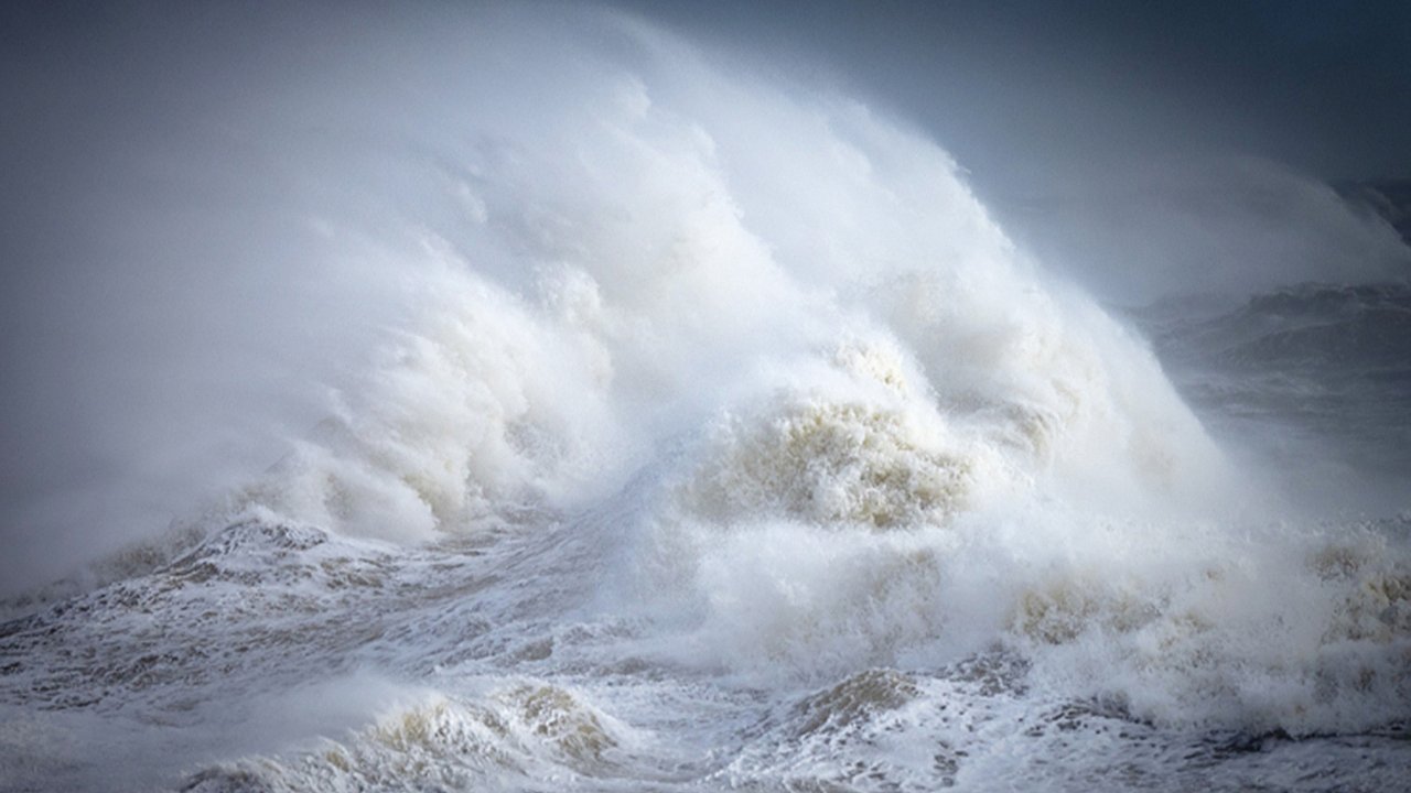
Developing rapidly in the Atlantic overnight on Saturday, Storm Ashley is predicted to undergo explosive cyclogenesis—a process where the storm’s central pressure drops by 24 millibars or more within 24 hours, intensifying its strength. This phenomenon, also known as "bombogenesis" or a "weather bomb", results in a sudden increase in wind speeds, making the storm a serious weather event.While most of the UK will experience strong winds, northern and western areas—including Scotland, Northern Ireland, north-west England, and north-west Wales—are expected to bear the brunt of the storm with gales or severe gales.Yellow Warnings and Coastal Threats
The yellow weather warning for wind covers large portions of the UK, particularly the north and west, where transport services may face significant disruption. With the Hunter's Moon occurring this week, the combination of high spring tides and strong winds raises the risk of coastal flooding and overtopping, posing dangers along exposed shores.Although Storm Ashley is forecast to clear northward by Monday, blustery conditions will persist throughout the day, keeping winds elevated even after the main storm has passed.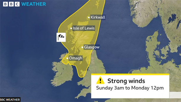 The Start of the 2024/25 UK Storm Naming Season
Storm Ashley is the first named storm of the 2024/25 season, which officially began on September 1 and runs until August 31, 2025. Following Ashley, the next storms on the alphabetical list will be named Bert and Conall.Storm names are selected by the Met Office, Met Éireann, or the Dutch weather service (KNMI) when they anticipate "medium" or "high" impacts from severe weather. The naming system is intended to improve public awareness of severe storms and their potential impacts.Prepare for Strong Winds and Coastal Flooding
With storm-force winds, coastal risks, and transport disruptions expected, the public is advised to stay updated with weather alerts and take necessary precautions. Check your travel plans, secure loose objects outdoors, and avoid coastal areas during the height of the storm.
Developing rapidly in the Atlantic overnight on Saturday, Storm Ashley is predicted to undergo explosive cyclogenesis—a process where the storm’s central pressure drops by 24 millibars or more within 24 hours, intensifying its strength. This phenomenon, also known as "bombogenesis" or a "weather bomb", results in a sudden increase in wind speeds, making the storm a serious weather event.While most of the UK will experience strong winds, northern and western areas—including Scotland, Northern Ireland, north-west England, and north-west Wales—are expected to bear the brunt of the storm with gales or severe gales.Yellow Warnings and Coastal Threats
The yellow weather warning for wind covers large portions of the UK, particularly the north and west, where transport services may face significant disruption. With the Hunter's Moon occurring this week, the combination of high spring tides and strong winds raises the risk of coastal flooding and overtopping, posing dangers along exposed shores.Although Storm Ashley is forecast to clear northward by Monday, blustery conditions will persist throughout the day, keeping winds elevated even after the main storm has passed.
The Start of the 2024/25 UK Storm Naming SeasonStorm Ashley is the first named storm of the 2024/25 season, which officially began on September 1 and runs until August 31, 2025. Following Ashley, the next storms on the alphabetical list will be named Bert and Conall.Storm names are selected by the Met Office, Met Éireann, or the Dutch weather service (KNMI) when they anticipate "medium" or "high" impacts from severe weather. The naming system is intended to improve public awareness of severe storms and their potential impacts.Prepare for Strong Winds and Coastal Flooding
With storm-force winds, coastal risks, and transport disruptions expected, the public is advised to stay updated with weather alerts and take necessary precautions. Check your travel plans, secure loose objects outdoors, and avoid coastal areas during the height of the storm.