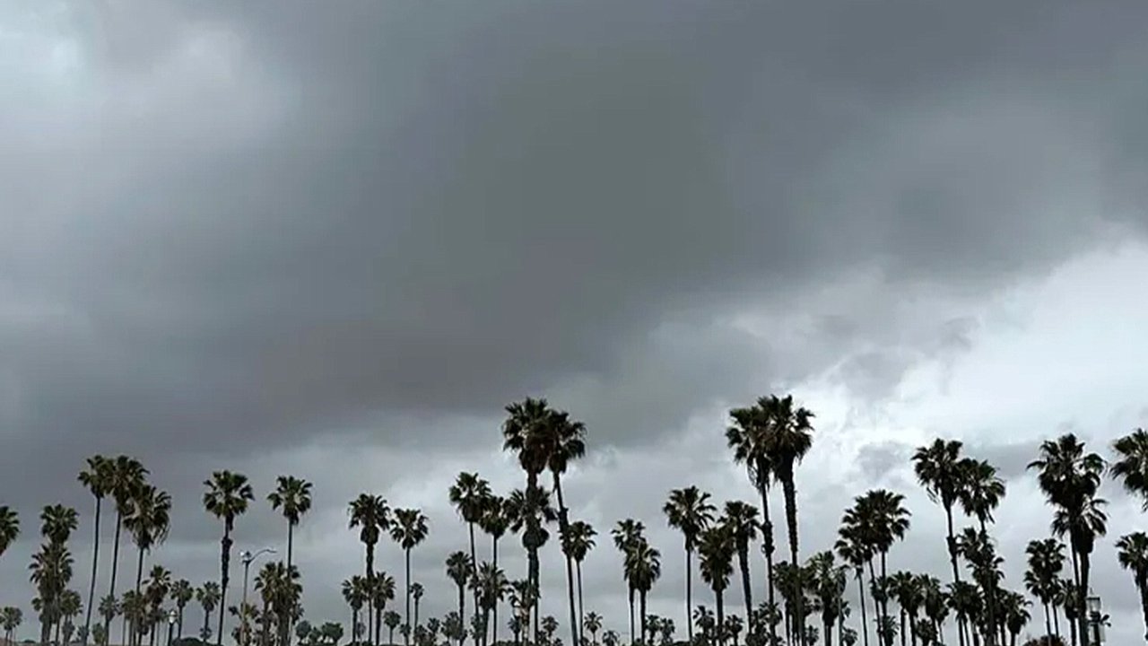
A powerful storm system targets San Diego CountyThis marks one of the first notable fall weather systems of the season, with temperatures dropping sharply after a string of mild autumn days. According to meteorologists, the incoming system will pack a quick punch, producing a burst of showers, powerful winds, and even some mountain snow before clearing out by midweek. While the storm won’t linger long, it is expected to make its presence felt across the county, affecting commuters, outdoor plans, and even marine activities along the coast.Rain and wind to intensify Monday night into TuesdayForecasters say the storm will begin making its impact late Monday as winds strengthen across inland and mountain regions. Gusts between 30 and 40 mph are likely, with wind-prone passes and desert slopes possibly experiencing gusts exceeding 55 mph. These strong winds could make travel challenging, particularly in areas like the San Gorgonio Pass and along Interstate 8 through the mountains.Rain is expected to spread from coastal areas inland overnight Monday, continuing into Tuesday night. The heaviest precipitation is likely during the early hours of Tuesday, when the low-pressure system moves directly overhead. Though rainfall totals are expected to remain moderate, the combination of wind and wet roads could lead to hazardous driving conditions.Colder air and mountain snow to arrive with the systemOne of the key features of this storm will be the arrival of significantly cooler air. Temperatures are expected to dip noticeably on Tuesday, with downtown San Diego forecast to reach only 68°F. For the first time this season, snow levels are predicted to drop to around 7,000 feet, bringing minor accumulations to higher-elevation resorts in the San Bernardino Mountains.The NWS indicated that “Big Bear Lake may see a dusting,” signaling the unofficial start of the high-elevation snow season. While the snow amounts are not expected to be significant, the colder air will bring a winter-like feel to the mountains after a prolonged warm spell.Coastal and maritime conditions to turn roughAlong the coast, the approaching storm will stir up the ocean, creating choppy conditions for mariners. The NWS marine forecast calls for winds of 20 to 25 knots and rough seas across all coastal waters on Tuesday. These conditions could make for challenging boating and fishing, and small craft advisories may be issued.Coastal residents can also expect a deeper marine layer with more extensive cloud cover and possible drizzle as the storm system interacts with the cooler ocean air. Surf conditions may remain unsettled through Tuesday night before gradually calming as the system departs.Midweek brings a return to calm and mild weatherBy Wednesday, the storm is expected to move eastward, leaving behind much quieter conditions across Southern California. Skies will begin to clear, and temperatures will start to climb again toward seasonal averages. Forecasters describe the upcoming pattern as “much more benign,” with pleasant fall weather returning through the end of the week.The NWS anticipates gradual warming inland while coastal regions continue to experience morning clouds and fog due to the marine layer. After Tuesday’s burst of activity, the rest of the week should offer stable weather, giving residents a break before the next potential system arrives later in October.Preparing for the brief but strong stormThough short-lived, this storm is a reminder that the fall transition period can bring sudden shifts in weather. Residents are advised to secure outdoor items that could be blown away by strong winds, check local travel forecasts, and avoid mountain travel during peak gusts if possible. Motorists should also be cautious on wet roads and be aware of potential debris from strong winds.With the first signs of cooler weather, the storm offers a preview of the upcoming winter season. As forecasters continue to monitor the system, San Diego County residents can expect a brisk, blustery start to the week before calm and sunny skies return.
According to meteorologists, the incoming system will pack a quick punch, producing a burst of showers, powerful winds, and even some mountain snow before clearing out by midweek. While the storm won’t linger long, it is expected to make its presence felt across the county, affecting commuters, outdoor plans, and even marine activities along the coast.Rain and wind to intensify Monday night into TuesdayForecasters say the storm will begin making its impact late Monday as winds strengthen across inland and mountain regions. Gusts between 30 and 40 mph are likely, with wind-prone passes and desert slopes possibly experiencing gusts exceeding 55 mph. These strong winds could make travel challenging, particularly in areas like the San Gorgonio Pass and along Interstate 8 through the mountains.Rain is expected to spread from coastal areas inland overnight Monday, continuing into Tuesday night. The heaviest precipitation is likely during the early hours of Tuesday, when the low-pressure system moves directly overhead. Though rainfall totals are expected to remain moderate, the combination of wind and wet roads could lead to hazardous driving conditions.Colder air and mountain snow to arrive with the systemOne of the key features of this storm will be the arrival of significantly cooler air. Temperatures are expected to dip noticeably on Tuesday, with downtown San Diego forecast to reach only 68°F. For the first time this season, snow levels are predicted to drop to around 7,000 feet, bringing minor accumulations to higher-elevation resorts in the San Bernardino Mountains.The NWS indicated that “Big Bear Lake may see a dusting,” signaling the unofficial start of the high-elevation snow season. While the snow amounts are not expected to be significant, the colder air will bring a winter-like feel to the mountains after a prolonged warm spell.Coastal and maritime conditions to turn roughAlong the coast, the approaching storm will stir up the ocean, creating choppy conditions for mariners. The NWS marine forecast calls for winds of 20 to 25 knots and rough seas across all coastal waters on Tuesday. These conditions could make for challenging boating and fishing, and small craft advisories may be issued.Coastal residents can also expect a deeper marine layer with more extensive cloud cover and possible drizzle as the storm system interacts with the cooler ocean air. Surf conditions may remain unsettled through Tuesday night before gradually calming as the system departs.Midweek brings a return to calm and mild weatherBy Wednesday, the storm is expected to move eastward, leaving behind much quieter conditions across Southern California. Skies will begin to clear, and temperatures will start to climb again toward seasonal averages. Forecasters describe the upcoming pattern as “much more benign,” with pleasant fall weather returning through the end of the week.The NWS anticipates gradual warming inland while coastal regions continue to experience morning clouds and fog due to the marine layer. After Tuesday’s burst of activity, the rest of the week should offer stable weather, giving residents a break before the next potential system arrives later in October.Preparing for the brief but strong stormThough short-lived, this storm is a reminder that the fall transition period can bring sudden shifts in weather. Residents are advised to secure outdoor items that could be blown away by strong winds, check local travel forecasts, and avoid mountain travel during peak gusts if possible. Motorists should also be cautious on wet roads and be aware of potential debris from strong winds.With the first signs of cooler weather, the storm offers a preview of the upcoming winter season. As forecasters continue to monitor the system, San Diego County residents can expect a brisk, blustery start to the week before calm and sunny skies return.